|
NY 53
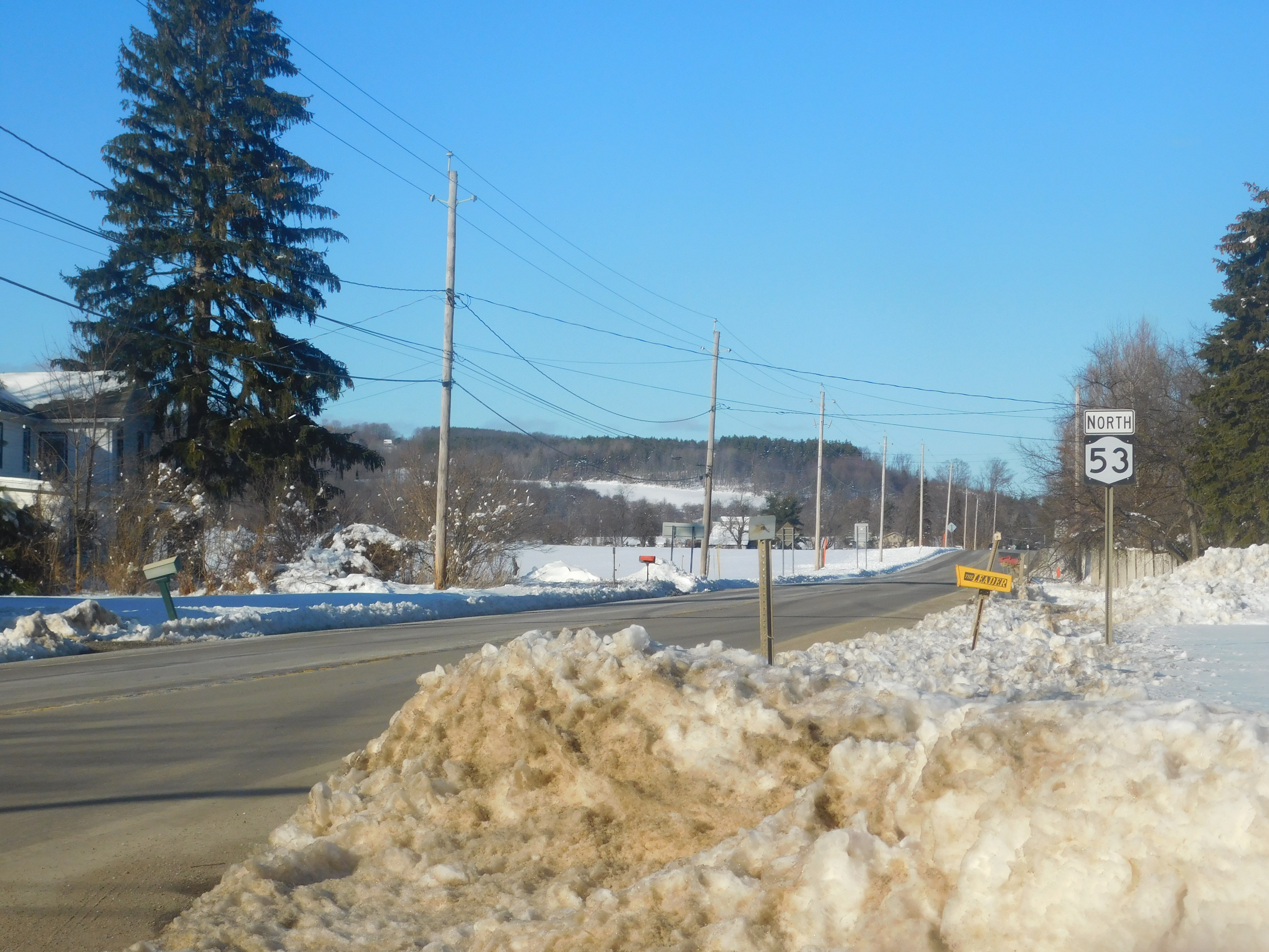
New York State Route 53 (NY 53) is a north–south state highway located in the Finger Lakes region of New York in the United States. It extends for from an intersection with NY 415 near the hamlet of Kanona in northern Steuben County to a junction with NY 21 in the village of Naples in southern Ontario County. Just north of Kanona, located within the town of Bath, NY 53 connects to the Southern Tier Expressway ( Interstate 86 or I-86 and NY 17). About midway between Kanona and Naples, the route serves the hamlet of Prattsburgh. When NY 53 was assigned as part of the 1930 renumbering of state highways in New York, it extended from Kanona in the south to the Canandaigua area in the north, utilizing what is now NY 247 north of Potter. At the same time, the piece of what is now NY 53 from Prattsburgh to Naples became NY 247. NY 53 was realigned onto its modern alignment from Prattsburgh to Naples in the early 19 ... [...More Info...] [...Related Items...] OR: [Wikipedia] [Google] [Baidu] |
Bath (town), New York
Bath is a town in Steuben County, New York, United States, with an area of 96.3 square miles (249 km2) and a population of 11,426 in 2020. Its largest settlement is the Village of Bath, which has an area of 2.9 sq mi (7.5 km2) and a population of 5,641 (in 2000). The Village is the county seat of Steuben County. The Town is located in the central part of the county, northwest of Elmira. The town and village are either named after the city of Bath in England or after Lady Bath, daughter of a landowner. History The town was founded in 1793 and was part of a land investment by wealthy Briton William Pulteney, and named after Bath, Somerset in England, where he owned extensive estates. It was created along with Steuben County in 1796 and became a mother town of the county, eventually yielding land to seven later towns. The Lackawanna Railroad opened its mainline through Bath, and opened a station, in 1882. Geography The United States Census Bureau lists the town's total area ... [...More Info...] [...Related Items...] OR: [Wikipedia] [Google] [Baidu] |
Potter, New York
Potter is a town in Yates County, New York, United States. The Town of Potter is located in the northwest part of the county and is south of Canandaigua. The population was 1,865 at the 2010 census. History Stafford C. Cleveland's ''History of Yates County, NY'' Potter was founded on April 26, 1832, when the town separated from nearby the Town of Middlesex. Previously, the region as a whole was known as District of Augusta. The town was initially known as "Potter's Town," as the area had been purchased by Arnold Potter a son of Judge William Potter. In December 1856, and additional were taken from Middlesex (Modern Potter contains ). Early settlers of the time included Rowes Perry, Benjamin Brown, Jesse Brown and Joshua Brown, Elias Gilbert, Jabez French, Abraham Lane, Isaac Lane and Jacob Lane, Francis Briggs and Peleg Briggs, Jr., Edward Craft, David Southerland and John Griffin. Around 1805, Griffin and Riggs operated an ashery store and a distillery north of Nettle ... [...More Info...] [...Related Items...] OR: [Wikipedia] [Google] [Baidu] |
New York State Route 364
New York State Route 364 (NY 364) is a state highway located in the Finger Lakes region of New York in the United States. It extends for from an intersection with NY 14A in Penn Yan to a junction with the concurrent routes of U.S. Route 20 (US 20) and NY 5 just east of the Canandaigua city limits. NY 364 follows a predominantly east–west alignment from Penn Yan to Middlesex and a north–south routing from Middlesex to Canandaigua, resulting in an L-shaped alignment. As a result, the route is posted as north–south north of Middlesex and east–west east of the hamlet. In the Canandaigua area, the road serves as a connector between US 20 and NY 5, Finger Lakes Community College, and the eastern shore of Canandaigua Lake. The origins of NY 364 date back to the 1920s when the Middlesex–Potter segment was briefly part of NY 52, the predecessor to today's NY 245. NY 364 was assigned as part of the 1930 renu ... [...More Info...] [...Related Items...] OR: [Wikipedia] [Google] [Baidu] |
1930 Renumbering (New York)
In January 1930, the U.S. state of New York implemented a major renumbering of its state highways. Many previously existing numbered routes were renumbered or realigned. At the same time, many state highways that were previously unnumbered received designations. Most of the highways with numbers in the 100s to 300s were assigned at this time. Route numbers were assigned in clusters based on their general location. Because some of these route numbers are no longer in use, the pattern of clusters is not fully apparent today. Before 1930, the route numbering system in place had its origins in the 1920s. At the time, New York only assigned numbers to a small subset of its state highways. Route numbers spanned from 1–80, with routes running primarily north–south having even numbers and routes generally running east–west having odd numbers. This scheme was abandoned with the advent of the U.S. Highway System in 1927. Some renumbering was done in 1927 to avoid overlapping route ... [...More Info...] [...Related Items...] OR: [Wikipedia] [Google] [Baidu] |
New York State Route 5
New York State Route 5 (NY 5) is a state highway that extends for across the state of New York in the United States. It begins at the Pennsylvania state line in the Chautauqua County town of Ripley and passes through Buffalo, Syracuse, Utica, Schenectady, and several other smaller cities and communities on its way to downtown Albany in Albany County, where it terminates at U.S. Route 9 (US 9), here routed along the service roads for Interstate 787 (I-787). Prior to the construction of the New York State Thruway, it was one of two main east–west highways traversing upstate New York, the other being US 20. West of New York, the road continues as Pennsylvania Route 5 (PA 5) to Erie. NY 5 overlaps with US 20 twice along its routing. The second, a overlap through western and central New York, is the second-longest concurrency in the state, stretching from Avon in Livingston County east to the city of Auburn in Cayu ... [...More Info...] [...Related Items...] OR: [Wikipedia] [Google] [Baidu] |
Kanona, New York
Bath is a town in Steuben County, New York, United States, with an area of 96.3 square miles (249 km2) and a population of 11,426 in 2020. Its largest settlement is the Village of Bath, which has an area of 2.9 sq mi (7.5 km2) and a population of 5,641 (in 2000). The Village is the county seat of Steuben County. The Town is located in the central part of the county, northwest of Elmira. The town and village are either named after the city of Bath in England or after Lady Bath, daughter of a landowner. History The town was founded in 1793 and was part of a land investment by wealthy Briton William Pulteney, and named after Bath, Somerset in England, where he owned extensive estates. It was created along with Steuben County in 1796 and became a mother town of the county, eventually yielding land to seven later towns. The Lackawanna Railroad opened its mainline through Bath, and opened a station, in 1882. Geography The United States Census Bureau lists the town's total area ... [...More Info...] [...Related Items...] OR: [Wikipedia] [Google] [Baidu] |
NY 53 In Italy
NY most commonly refers to: * New York (state), a state in the Northeastern United States * New York City, the most populous city in the United States, located in the state of New York NY, Ny or ny may also refer to: Places * North Yorkshire, an English county * Ny, Belgium, a village * Old number plate of German small town Niesky People * Eric Ny (1909–1945), Swedish runner * Marianne Ny, Swedish prosecutor Letters * ny (digraph), an alphabetic letter * Nu (letter), the 13th letter of the Greek alphabet, transcribed as "Ny" * ñ (énye), sometimes transcribed as "ny" Other uses * New Year * Air Iceland (IATA code: NY) * Chewa language (ISO 639-1 code: ny) See also * New Year (other) * New York (other) * NYC (other) * NYS (other) NYS may refer to: *New York Skyports Seaplane Base (IATA: NYS) * National Youth Service (other), National Youth Service, of several countries * New York State * New York Shipbuilding, a corpor ... [...More Info...] [...Related Items...] OR: [Wikipedia] [Google] [Baidu] |
Prattsburgh, New York
Prattsburgh is a town in Steuben County, New York, United States. The population was 1,985 at the 2020 census. It is situated in the northeast part of the county, north of Bath. History Prattsburgh was formed from the town of Pulteney in 1813. The Prattsburgh community is named after early settler Joel Pratt, who arrived around 1799 to purchase land. Settlers arrived in 1801. From c. 1889-1961 Prattsburgh was located on a railroad. The Kanona & Prattsburgh Railroad Company, the Kanona & Prattsburgh Railway Company, and the Prattsburgh Railway Corporation during the period operated an 11.44 single-track standard-gauge railroad from a connection with the Erie Railroad at Kanona to Prattsburgh. Intermediate stations included Wheeler, Beans, and Stickneys. Geography According to the United States Census Bureau, the town has a total area of , of which, of it is land and of it (0.06%) is water. The north town line is the border of Steuben County and Yates County. New York ... [...More Info...] [...Related Items...] OR: [Wikipedia] [Google] [Baidu] |
Wheeler, New York
Wheeler is a town in Steuben County, New York, United States. The population was 1,136 at the 2020 census. The town is named after Captain Silas Wheeler, an early settler. The Town of Wheeler is in the northern part of the county, north of Bath. History The town was organized in 1820 from the Towns of Bath and Prattsburgh. Wheeler lost some of its territory to Avoca (1843) and Urbana (1839). The town was at its peak population in 1850: 1,471. Geography According to the United States Census Bureau, the town has a total area of , of which is land and (0.09%) is water. New York State Route 53 is a north-south highway through the town. From c. 1889-1961, Wheeler was located on a railroad. The Kanona & Prattsburgh Railroad Company, the Kanona & Prattsburgh Railway Company, and the Prattsburgh Railway Corporation during the period operated an 11.44 single-track standard-gauge railroad from a connection with the Erie Railroad at Kanona to Prattsburgh. Intermediate station ... [...More Info...] [...Related Items...] OR: [Wikipedia] [Google] [Baidu] |
Interstate 390
Interstate 390 (I-390) is a north–south auxiliary Interstate Highway located entirely within New York in the United States. The southern terminus of the route is at the Southern Tier Expressway (I-86 and New York State Route 17 Y 17 in the town of Avoca. Its northern terminus is at I-490 (Western Expressway) in Gates, just west of Rochester. North of I-490, the expressway continues as NY 390 to the Lake Ontario State Parkway in Greece. I-390 connects to its parent, I-90 (New York State Thruway), in Henrietta, a southern suburb of Rochester. The route is known as the Genesee Expressway from Avoca to I-590 in Brighton, where it becomes part of the Rochester Outer Loop. In addition to serving Rochester, I-390 serves as an important connecting route between the Rochester metropolitan area and Corning and the rest of the Southern Tier of New York. The freeway also serves several smaller communities between Corning and Rochester, including the Livingston County ... [...More Info...] [...Related Items...] OR: [Wikipedia] [Google] [Baidu] |
Cohocton River
The Cohocton River, sometimes referred to as the Conhocton River, is a U.S. Geological Survey. National Hydrography Dataset high-resolution flowline dataThe National Map, accessed August 8, 2011 tributary of the Chemung River in western New York in the United States. Via the Chemung River, it is part of the Susquehanna River watershed, flowing to Chesapeake Bay. The name "Cohocton" is derived from an Iroquois term, ''Ga-ha-to'', meaning "log floating in the water" or "trees in the water". New York State Route 17 follows the valley of the river along much of its route through Steuben County. The river is a popular destination for fly fishing. History In the 1820s the New York State Legislature commissioned a study for the building of a canal that would link the Cohocton at Bath to Keuka Lake (Crooked Lake) and Seneca Lake. The Crooked Lake Canal connecting the two lakes was built, but the link to the Cohocton was never completed. Course and watershed The Cohocton River rises in ... [...More Info...] [...Related Items...] OR: [Wikipedia] [Google] [Baidu] |
Rand McNally And Company
Rand McNally is an American technology and publishing company that provides mapping, software and hardware for consumer electronics, commercial transportation and education markets. The company is headquartered in Chicago, with a distribution center in Richmond, Kentucky. History Early history In 1856, William H. Rand opened a printing shop in Chicago and two years later hired a newly arrived Irish immigrant, Andrew McNally, to work in his shop. The shop did big business with the forerunner of the ''Chicago Tribune'', and in 1859 Rand and McNally were hired to run the ''Tribune''s entire printing operation. In 1868, the two men, along with Rand's nephew George Amos Poole, established Rand McNally & Co. and bought the Tribune's printing business. The company initially focused on printing tickets and timetables for Chicago's booming railroad industry, and the following year supplemented that business by publishing complete railroad guides. In 1870, the company expanded into ... [...More Info...] [...Related Items...] OR: [Wikipedia] [Google] [Baidu] |


